115 Creek former Provincial Campg to Watson Lake
Mac Donald River Bridge (below). This next stretch of 300 miles to Watson Lake is considered

to be the most scenic part of the highway.


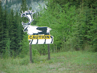
I ask you, does that really look like a horse? The idea is to watch out for horses on the road. In 1942 the Army used horses to haul away excavated rocks. The original Alcan route went along the top of the cliffs. When that proved to be hazardous, the Army relocated the road by "benching into the cliffs" a few feet above lake level.

Above is the beginning of many snow capped mountains for the next couple of days.
 Above is the south end of Muncho Lake, known in the area for its beautiful deep green and blue waters. The lake is 7 miles long, and 1 mile in width.
Excellent fishing in Muncho Lake for lake trout, white fish, grayling and burbot!
The Historical Road Marker 463 stands at the north end of Muncho Lake.

Muncho Lake drains into the "raging" Trout River (right).

Trout River Valley (left).

We spied 2 Buffalo grazing along the roadside.

Liard River Valley

Sitka Valerian

Willow Family

Northern Labrador Tea

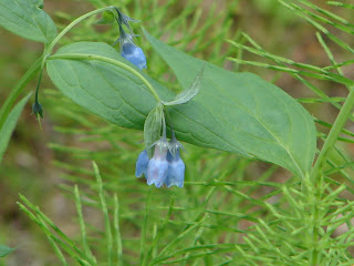
Tall Bluebells

First Moose sighting.
Liard Hot Springs Bog area.

Liard Hot Springs, view of larger hot water and
waterfall in background leading to warm water
for cooling off after the hot temperatures
ranging from 108 to 126 degrees F.
In the lower section you can feel the natural
springs bubbling up. Sure was a nice break in a
day of driving.

Long view of the Liard Hot Springs at the
Liard Hot Springs Provincial Park

Liard Valley

The "mighty" Liard River was named by
French-Canadian voyageurs for the poplar
"liard" that line the banks of the lower river.
The river offered the engineers a natural line
to follow during routing and construction of the
Alaska Highway.

 Northern Gentian


0 Comments:
Post a Comment
Subscribe to Post Comments [Atom]
<< Home